The Site module records the physical details about a site. A site is usually the location of a collection event![]() An expedition to locate items typically with the intention of adding them to a collection.. A site record contains location details such as jurisdiction, geographic and / or political locality, elevation, size and geo-spatial information used for mapping.
An expedition to locate items typically with the intention of adding them to a collection.. A site record contains location details such as jurisdiction, geographic and / or political locality, elevation, size and geo-spatial information used for mapping.
A Sites record includes:
- Site-specific information, including name, jurisdiction
- Locality, including geographic and / or political locality, elevation, size, etc.
- Elevation, size and geo-spatial information (for mapping)
While both the Collection Events module and Sites module describe a locality and its physical details there is an important distinction to be made between them:
- The Collection Events module records the physical locality details for a specific event, e.g. the elevation at which an object is found or the depth at which a fish is caught. These details may differ for different collection events even if the event occurs at the same site.
- The Site module records the physical details of a specific locality, e.g. altitude, town, latitude and longitude. These details are constant and do not change with time.
Note: A Collection Events record can attach to the Sites module via the Site: (Collection Details) field.
Note: As every institution is able to customize EMu to suit its requirements, there are many different versions of EMu. Even where institutions have the same modules, the tabs included in each instance of the module may be different; and even where institutions have tabs with the same name, the fields on those tabs may be different. For that reason this section only provides a general description of modules.
| Tab | Description |
|---|---|
|
Site |
Holds details such as:
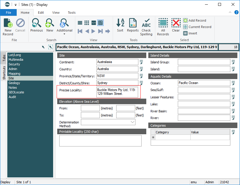
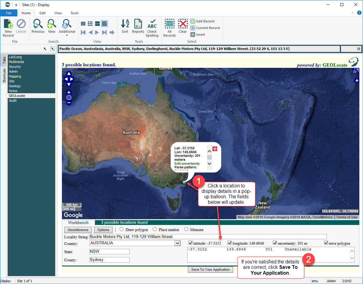
Precise Locality details entered on the Site tab are used on the GEOLocate tab (see below) to identify possible geolocations for the site on a world map: |
|
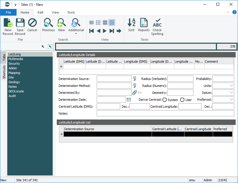
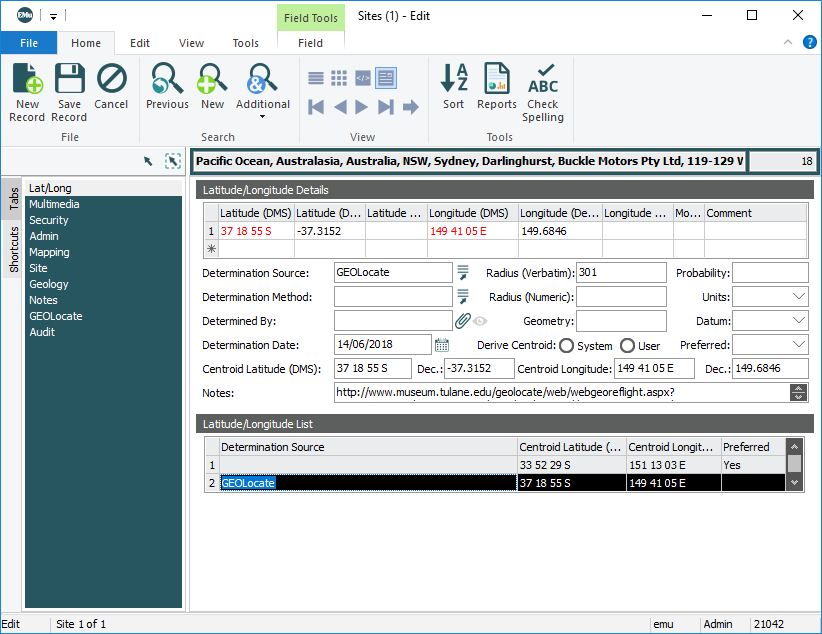
In Display mode, the Lat/Long tab holds geo-referencing information. The Lat/Long tab is designed to contain all locality co-ordinate information and associated error values: We examine the Lat/Long tab in detail here. |
|
|
Lat/Long and Lat/Long (Pref) |
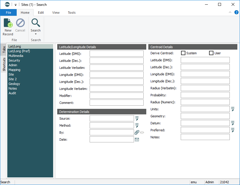
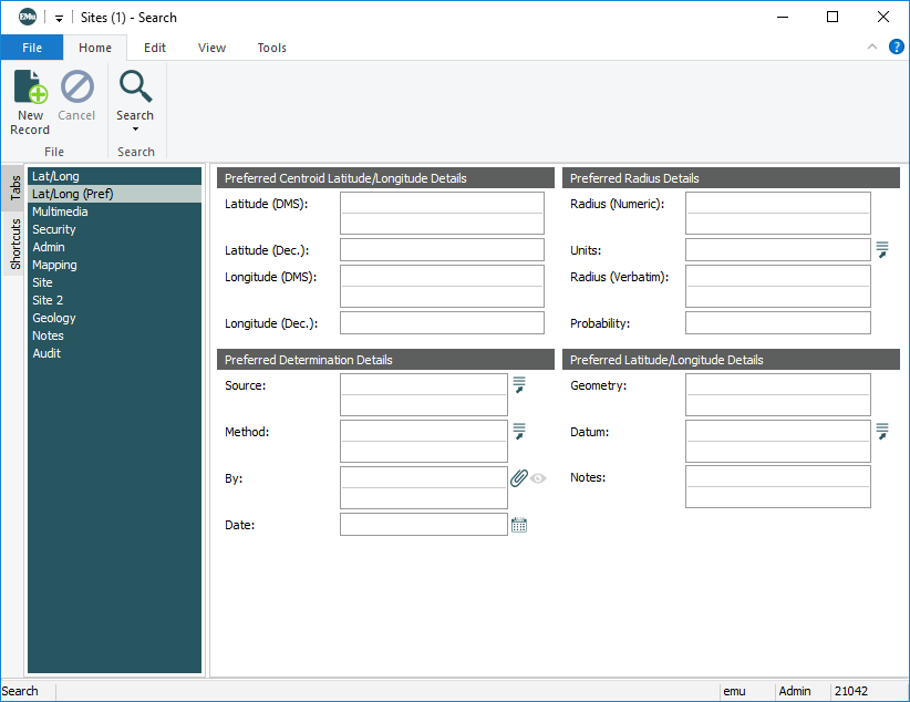
In Search mode, two tabs provide query access to geo-referencing data. The first is the Lat/Long search tab. Fields that can be searched correspond to the fields on the Lat/Long display tab: The second tab, Lat/Long (Pref), limits searches to opinions where Preferred is set to Yes. The simplified data view provides for easier searching and reporting on the Preferred opinion: |
|
Mapping |
Site mapping details, including:
|
|
Connects to the GEOLocate web service. Details entered on the Locality tab are used to identify possible geolocations for the site on a world map:
See GEOLocate Registry entries for details about configuring the GEOLocate facility. |
|
|
Notes |
See Notes tab for details. |
|
Multimedia |
See Multimedia tab for details. |
|
Security |
See Security tab for details. |
|
Audit |
See Audit tab for details. |
|
Admin |
See Admin tab for details. |
Geo-referencing is the process of determining locality co-ordinates (Latitude, Longitude, Eastings, Northings, etc.) and associated error.
The following notes concern the historical development of geo-referencing in EMu and may be of interest in understanding how precision is calculated:
In response to a proposal submitted to the Ideas Portal, the geographic coordinates of existing record latitude and longitude values are plotted using the GEOLocate client instead of always geo-referencing the record locality values.
To help distinguish between the two cases, the Workbench section of the GEOLocate tab is initially displayed when geo-referencing (this was the previous behaviour) and the Results section, which lists locations, is initially displayed when plotting existing geographic coordinates.
Other minor improvements to the GEOLocate client are:
-
Improved geo-referencing speed by reducing the number of page loads.
-
When geo-referencing, prevent the GEOLocate client from defaulting to use "UNITED STATES OF AMERICA" as the Workbench country value when the record does not have a specified country value.
At the North American User Group meeting in Chicago in 2005 the EMu Natural History Special Interest Group (NH SIG) proposed the design of a common tab for storing geo-referencing information. The following recommendations were implemented in the Sites module and Collection Events module from EMu 4.0 onwards.
- A common display tab and associated search tabs were designed and built.
- Support for multiple opinions was added, allowing data from various sources to be recorded (e.g. a set of co-ordinates from a GPS device, another set from a map reading and another set derived automatically from the Precise Location via BioGeomancer).
- A set of common columns was added to both the Sites and Collection Events modules, allowing for easier data interchange.
- The calculation of centroid values was updated to use the new columns.
The centroid computation is now performed via an external service (fifo server) and used by the Windows client and the database server.
- The precision was modified to imply more accuracy for all computations where the form of a Latitude or Longitude is changed (e.g. Degrees / Minutes / Seconds to Decimal).
EMu 3.1 saw changes made to the conversion of latitude and longitude values between decimal (Dec) and Degrees / Minutes / Seconds (DMS) formats. The rule applied (as used throughout EMu) was that a calculated value should never imply more precision than the original value. While this rule is useful in general it does cause problems with geo-referencing data. Using the decimal representation the precision of a latitude / longitude value is 1/10, however for DMS the precision is 1/60; thus when converting from DMS to decimal noticeable precision is lost. If a decimal precision of 1/100 is used, a slight gain in precision over DMS occurs.
The EMu NH SIG recommended a change in how precision should be handled when converting between latitude / longitude values in DMS and decimal formats. The following recommendations were implemented:
- If a DMS value is entered, the decimal value will be converted to two decimal places if seconds is missing, four decimal places if whole seconds is provided, five decimal places if one second decimal place is provided, six decimal places if two seconds decimal places are provided, and seven if three seconds decimal places are provided, etc.
- If a decimal value is entered, the precision of the DMS should be calculated in reverse of the above. Two decimal places round to minutes, three or four decimal places round to seconds, five decimal places round to tenths of a second, six decimal places round to hundredths of a second, seven decimal places round to thousandths of a second, etc.
- Centroid calculations should be given one degree of precision greater than the least precise latitude / longitude value in the group. Although this may be implying an increase in degree of accuracy, it is only one degree and will help lessen the skewing of the centroid values. The centroid calculator does not imply extra precision where a single latitude / longitude pair is specified.
